

Your cart is empty
You may check out all the available products and buy some in the shop
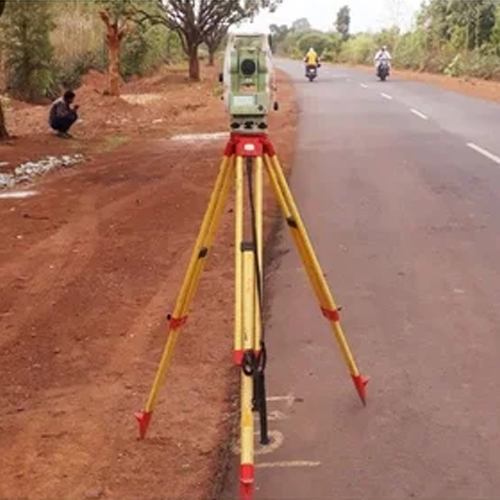
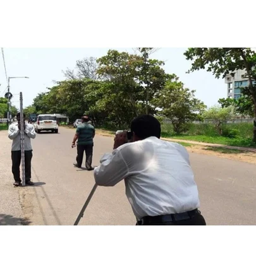
Return to shopOur Topographical Survey services provide accurate and detailed mapping of land features, helping engineers, architects, developers, and planners make informed decisions before starting any project. We capture natural and man-made features such as elevations, contours, boundaries, roads, buildings, utilities, trees, and drainage systems using advanced surveying equipment and modern techniques.
With precise data and comprehensive survey reports, we ensure smooth project planning, design, construction, and land development while minimizing risks and costly errors. Our team is committed to delivering reliable, high-quality survey solutions tailored to your project requirements.
Key Features:
Every successful construction, infrastructure, or land development project starts with one critical question: what does the land actually look like? A topographical survey answers that question — capturing every contour, elevation change, natural feature, and existing structure on a plot before design and construction begin.
Skip this step or get it wrong, and you risk flawed drainage planning, incorrect earthwork estimates, road design failures, and costly on-site surprises during construction.
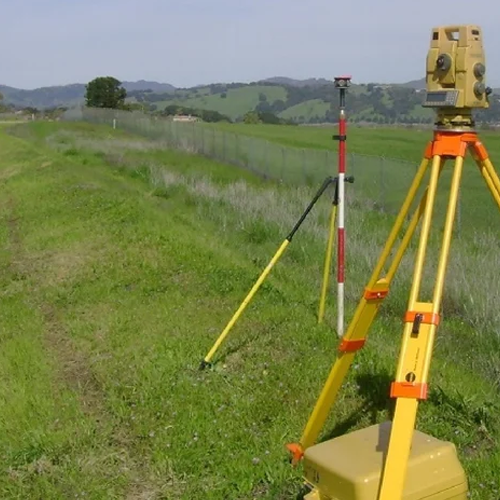
We provide professional topographical survey services using drone mapping and total station technology, helping architects, civil engineers, real estate developers, and government infrastructure projects get an accurate, reliable picture of the land — the first time.
Our teams currently serve Delhi NCR, and major districts across West Bengal, Odisha, Bihar, and Jharkhand, covering everything from small residential plots to large-scale industrial and infrastructure sites.
A topographical survey captures the natural and man-made features of a piece of land — elevation changes, slopes, water bodies, vegetation, existing structures, and boundary details — and translates them into an accurate map or 3D model. Without this data, projects commonly run into:
Our topographical survey team delivers detailed, accurate data that architects and engineers can rely on for design, planning, and approval stages.
We work with real estate developers, civil engineering firms, government infrastructure agencies, and independent architects, offering both one-time project surveys and phase-wise data collection for large developments.
We are among the most experienced topographical survey companies in Delhi NCR, handling projects ranging from compact urban plots to large township and infrastructure developments.
Cities we serve in Delhi NCR: Delhi, Gurugram, Noida, Greater Noida, Ghaziabad, Faridabad, Sonipat, Panipat, Rohtak, Meerut, Bulandshahr, Alwar, Bhiwadi, Rewari, and Palwal.
Our topographical survey services in Gurugram and drone topographical survey in Noida are widely used by developers planning large residential and commercial projects. We also provide contour survey services in Faridabad, Sonipat, and Ghaziabad, supporting fast-paced urban development across the region.
If you’re looking for a topographical survey company near Alwar, Bhiwadi, or Rewari, our team can mobilize within 24–48 hours with full drone and total station equipment.
From dense urban plots in Kolkata to industrial land in Durgapur and Asansol, our team delivers accurate topographical survey services across West Bengal.
Districts we serve: Kolkata, Howrah, Durgapur, Asansol, Siliguri, Malda, Kharagpur, Bardhaman (Burdwan), Nadia (Krishnanagar), Hooghly (Chinsurah), North 24 Parganas (Barasat), South 24 Parganas (Alipore), Purulia, and Cooch Behar.
We provide topographical survey services in Kolkata and Howrah for commercial and residential development, along with drone topographical mapping in Siliguri and Durgapur for large land parcels. Our team has also completed elevation surveys in Bardhaman, Malda, and Kharagpur, supporting both private developers and infrastructure projects.
As Odisha’s industrial and infrastructure sector grows, our topographical survey services support projects across the state’s major districts.
Districts we serve: Bhubaneswar, Cuttack, Rourkela, Berhampur (Brahmapur), Sambalpur, Puri, Balasore, Bhadrak, Baripada (Mayurbhanj), Angul, Jharsuguda, Koraput, Kendrapara, and Jajpur.
We offer topographical survey services in Bhubaneswar and Cuttack for real estate and infrastructure projects, along with total station topographic surveys in Rourkela and Sambalpur, supporting industrial land development. Our drone-based contour mapping in Puri and Balasore is especially valuable for coastal land assessment.
Our team supports Bihar’s rapidly growing construction and infrastructure sector with accurate, reliable topographical survey services.
Districts we serve: Patna, Gaya, Bhagalpur, Muzaffarpur, Darbhanga, Purnia, Ara (Bhojpur), Begusarai, Chapra (Saran), Katihar, Munger, Nalanda (Bihar Sharif), Samastipur, and Motihari (East Champaran).
We provide topographical survey services in Patna and Gaya for residential and commercial construction, along with land topographical surveys in Muzaffarpur, Bhagalpur, and Darbhanga, supporting both private builders and government infrastructure works.
Our topographical survey services in Jharkhand support the state’s mining, industrial, and urban development projects with precise land elevation and contour data.
Districts we serve: Ranchi, Jamshedpur, Dhanbad, Bokaro, Deoghar, Hazaribagh, Giridih, Ramgarh, Dumka, Phusro, Chaibasa (West Singhbhum), Chatra, Gumla, and Palamu (Daltonganj).
We offer topographical survey services in Ranchi and Jamshedpur for industrial and residential projects, along with drone topographical surveys in Dhanbad and Bokaro, where large mining and industrial land parcels require fast, accurate mapping.
✅ Multi-state coverage across Delhi NCR, West Bengal, Odisha, Bihar & Jharkhand ✅ Drone + total station technology for fast, high-precision mapping ✅ Fast mobilization — team on-site within 24–48 hours ✅ Experienced with architectural, civil, and government project requirements ✅ Transparent, per-acre pricing — no hidden costs ✅ Trusted by developers, engineers, and infrastructure agencies
1. What is a topographical survey? A topographical survey captures the natural and man-made features of a piece of land — including elevation, contours, slopes, water bodies, and existing structures — used for design, planning, and construction decisions.
2. Which locations do you provide topographical survey services in? We currently serve Delhi NCR, and major districts across West Bengal, Odisha, Bihar, and Jharkhand.
3. Do you use drones for topographical surveys? Yes, we use drone-based mapping for large land parcels combined with total station equipment for high-precision elevation data where needed.
4. How much does a topographical survey cost? Pricing depends on land size, terrain, and location — we offer transparent per-acre pricing. Contact us for a customized quote.
5. How long does a topographical survey take? Turnaround time depends on plot size and survey method, but drone-based surveys significantly reduce time for large land parcels compared to manual methods.
6. Is a topographical survey required for government project approvals? Yes, most municipal and infrastructure approvals require topographical survey data to verify land elevation, drainage patterns, and existing site conditions.
Whether you’re planning a residential project in Patna, an industrial site in Jamshedpur, a township in Bhubaneswar, or a commercial development in Gurugram — our experienced survey team delivers the accurate land data your project needs. Contact us today for a free site assessment and quote.
WhatsApp us
Address: 1234 Fashion Street, Suite 567,
New York, NY 10001
Email: info@fashionshop.com
You may check out all the available products and buy some in the shop
Return to shop