


Your cart is empty
You may check out all the available products and buy some in the shop
Return to shopPrecision Surveying & Digital Mapping Solutions
At CAD Astral Surveys, we provide accurate land surveying, mapping, and geospatial solutions to support construction, infrastructure, engineering, and development projects. Using advanced surveying equipment and industry-leading CAD technology, our team delivers reliable data that helps clients make informed decisions and execute projects with confidence.
Our services include topographical surveys, boundary surveys, contour mapping, construction layout surveys, GPS surveys, and digital CAD drafting. We focus on accuracy, efficiency, and timely project delivery, ensuring that every survey meets the highest professional standards.
Whether you are planning a new development, managing a construction project, or requiring detailed land measurements, CAD Astral Surveys offers dependable surveying solutions tailored to your specific requirements.
Our Services Include:
Land ownership disputes, unclear property boundaries, and inaccurate land records cause more legal and financial headaches than almost any other property issue. A cadastral survey solves this at the root—precisely determining and legally documenting the exact boundaries of a land parcel.
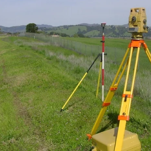
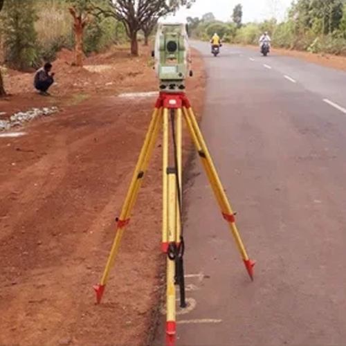
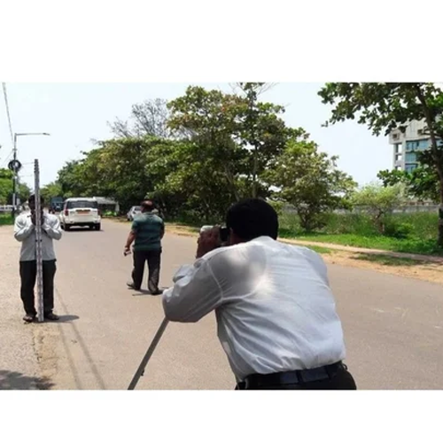
We provide professional cadastral survey services, using total station and GPS-based survey technology to establish accurate property boundaries, support land registration, and resolve boundary disputes with legally verifiable data.
Our teams currently serve major districts across Chhattisgarh, Assam, Arunachal Pradesh, and Delhi, supporting individual property owners, real estate developers, government land departments, and legal professionals.
A cadastral survey determines and documents the precise boundaries, area, and ownership details of a land parcel. Unlike other survey types focused on construction or infrastructure, cadastral surveys are fundamentally about legal land identity—establishing exactly where one property ends and another begins.
Cadastral surveys are essential for:
Without an accurate cadastral survey, property owners risk boundary disputes, registration delays, and legal complications that can take years to resolve.
We work with individual property owners, real estate developers, government revenue and land record departments, and legal professionals handling property matters across all our serviceable states.
Our team supports both urban property transactions and rural land record modernization with reliable cadastral survey services across Chhattisgarh.
Districts we serve:
Raipur, Bilaspur, Durg, Korba, Bhilai, Rajnandgaon, Jagdalpur (Bastar), Raigarh, Ambikapur (Surguja), Dhamtari, Mahasamund, Kanker, Kawardha, and Janjgir-Champa.
We provide cadastral survey services in Raipur and Bilaspur for property registration and boundary verification, along with land boundary surveys in Durg and Bhilai, supporting real estate transactions. Our revenue survey services in Korba and Raigarh support government land record projects across the state’s industrial belt.
From urban property boundaries in Guwahati to rural land records in Nagaon and Sivasagar, our team delivers accurate cadastral survey services across Assam.
Districts we serve:
Guwahati, Dibrugarh, Silchar, Jorhat, Nagaon, Tinsukia, Tezpur, Bongaigaon, Karimganj, Sivasagar, Dhubri, Golaghat, Barpeta, and Nalbari.
We offer cadastral survey services in Guwahati and Dibrugarh for property registration and boundary demarcation, along with land boundary surveys in Silchar and Jorhat, supporting both residential and commercial property transactions across the state.
Land ownership in Arunachal Pradesh often involves unique customary and community land arrangements—our team brings the technical precision of modern cadastral surveying to support clear, documented boundaries.
Districts we serve:
Itanagar, Naharlagun, Pasighat, Tawang, Ziro, Bomdila, Along (Aalo), Tezu, Roing, Namsai, Khonsa, Changlang, Seppa, and Yingkiong.
We provide cadastral survey services in Itanagar and Naharlagun for property registration and boundary verification, along with land boundary surveys in Pasighat and Tawang, supporting both government land record efforts and private property documentation across the state’s varied terrain.
Our team provides precise cadastral survey services across Delhi, supporting property transactions, boundary disputes, and land record verification in one of India’s most valuable real estate markets.
Areas we serve:
New Delhi, North Delhi, South Delhi, East Delhi, West Delhi, North West Delhi, South West Delhi, Shahdara, Dwarka, Rohini, Najafgarh, and Karol Bagh.
We offer cadastral survey services in South Delhi and West Delhi for high-value property boundary verification, along with property demarcation surveys in Dwarka and Rohini, supporting residential and commercial property registration. Our boundary dispute survey services in Najafgarh and Shahdara help resolve property line conflicts with legally verifiable data.
✅ Legally defensible boundary data using total station & GPS technology
✅ Multi-state coverage across Chhattisgarh, Assam, Arunachal Pradesh & Delhi
✅ Experienced with government revenue department requirements
✅ Fast mobilization — team on-site within 24–48 hours
✅ Survey reports formatted for property registration and legal use
✅ Trusted by property owners, developers, and legal professionals
1. What is a cadastral survey?
A cadastral survey determines and documents the precise boundaries, area, and ownership details of a land parcel—used for property registration, boundary disputes, and land record purposes.
2. Which locations do you provide cadastral survey services in?
We currently serve major districts across Chhattisgarh, Assam, Arunachal Pradesh, and Delhi.
3. Can a cadastral survey help resolve a boundary dispute?
Yes, our cadastral surveys provide precise, legally defensible boundary data that can be used as evidence in resolving property boundary disputes.
4. Do I need a cadastral survey before registering my property?
In many cases, accurate boundary documentation is required or strongly recommended for property registration — our cadastral survey reports are prepared to support this process.
5. How much does a cadastral survey cost?
Pricing depends on plot size, location, and complexity of the boundary determination. Contact us for a customized quote based on your property.
6. How is a cadastral survey different from a building layout survey?
A cadastral survey focuses specifically on legal property boundaries and land ownership documentation, while a building layout survey focuses on setting out construction points within an already defined property boundary.
Whether you’re registering a property in Delhi, resolving a boundary dispute in Raipur, verifying land records in Guwahati, or documenting a land parcel in Itanagar — our experienced cadastral survey team delivers the precise, legally sound boundary data your property needs. Contact us today for a free consultation and quote.
WhatsApp us
Address: 1234 Fashion Street, Suite 567,
New York, NY 10001
Email: info@fashionshop.com
You may check out all the available products and buy some in the shop
Return to shop