

Your cart is empty
You may check out all the available products and buy some in the shop
Return to shopPrecise Route Planning for Successful Infrastructure Projects
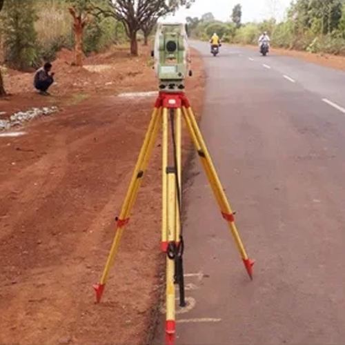
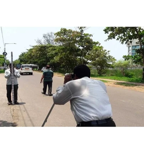
Our Alignment Survey services provide accurate ground data for the planning, design, and construction of roads, railways, pipelines, and ropeways. Using advanced surveying equipment and modern geospatial technologies, we identify the most suitable alignment while considering terrain, environmental factors, land features, and project requirements.
We conduct detailed topographic surveys, route mapping, profile and cross-section surveys, and corridor studies to ensure optimal alignment selection. Our experienced survey team delivers reliable data that helps reduce construction risks, improve project efficiency, and support informed engineering decisions.
Our Alignment Survey Services Include:
Benefits:
✔ Accurate route selection
✔ Reduced construction costs and delays
✔ Reliable data for engineering design
✔ Improved project planning and execution
✔ Compliance with industry standards and specifications
Linear infrastructure projects — roads, railways, pipelines, and ropeways — don’t just need accurate data at one point. They need precise, continuous survey data along an entire route, often spanning kilometers of varied terrain. This is exactly what an alignment survey delivers.
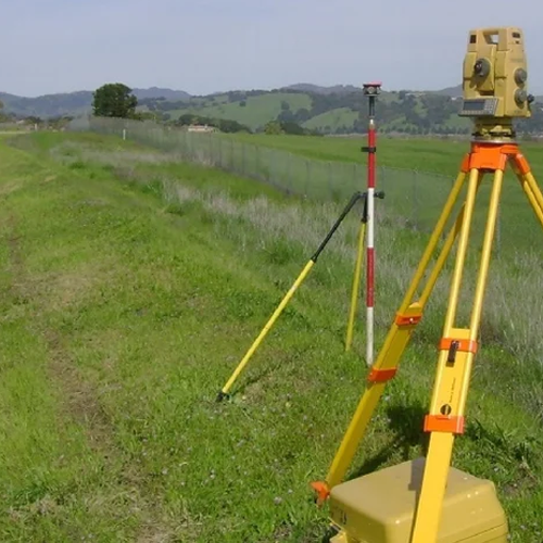
We provide specialized alignment survey services for road, rail, pipeline, and ropeway projects, using total station, GPS, and drone technology to capture accurate centerline, elevation, curvature, and cross-section data — the backbone of every successful linear infrastructure project.
Our teams currently serve Delhi NCR, and major districts across Chhattisgarh, Assam, and Arunachal Pradesh, handling projects across flat plains, dense forests, riverine terrain, and steep Himalayan foothills.
An alignment survey maps the exact route a road, railway line, pipeline, or ropeway will follow — capturing centerline coordinates, elevation profiles, gradients, curves, and crossing points along the entire corridor. It’s one of the most technically demanding survey types because:
Our alignment survey teams are experienced across all four major project types, each with its own technical requirements.
Centerline marking, cross-section surveys, curvature and gradient mapping, and right-of-way (ROW) surveys for highways, expressways, and rural road projects.
Precise gradient and curvature surveys for new railway lines, track doubling projects, and railway route realignment — meeting the strict tolerance standards required for rail infrastructure.
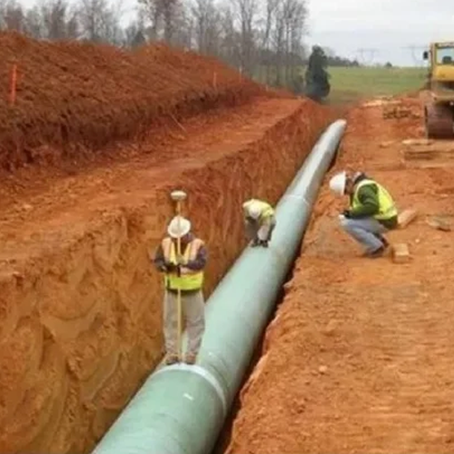
Cross-country route surveys for oil, gas, and water pipelines, including crossing point identification (roads, rivers, railway lines), elevation profiling, and route corridor mapping.
Specialized survey services for cable car and ropeway projects in hilly and mountainous terrain, including tower point marking, span length calculation, and elevation profiling across difficult-to-access slopes.
Additional services:
We work with road and highway contractors, railway infrastructure agencies, pipeline EPC companies, ropeway developers, and government infrastructure departments across all our serviceable states.
We provide road, rail, pipeline, and ropeway alignment survey services across Delhi NCR, supporting both government infrastructure projects and private EPC contracts.
Cities we serve in Delhi NCR:
Delhi, Gurugram, Noida, Greater Noida, Ghaziabad, Faridabad, Sonipat, Panipat, Rohtak, Meerut, Bulandshahr, Alwar, Bhiwadi, Rewari, and Palwal.
Our road alignment survey services in Gurugram and Noida support highway and expressway expansion projects, while our pipeline alignment surveys in Ghaziabad and Faridabad serve cross-country pipeline contractors working near the NCR industrial belt.
Chhattisgarh’s expanding road, rail, and industrial pipeline network relies on our alignment survey expertise across the state’s major districts.
Districts we serve:
Raipur, Bilaspur, Durg, Korba, Bhilai, Rajnandgaon, Jagdalpur (Bastar), Raigarh, Ambikapur (Surguja), Dhamtari, Mahasamund, Kanker, Kawardha, and Janjgir-Champa.
We provide road alignment survey services in Raipur and Bilaspur for highway projects, along with rail alignment surveys in Durg and Bhilai, supporting the state’s growing railway infrastructure. Our pipeline alignment surveys in Korba and Raigarh serve the region’s coal and industrial pipeline projects.
From highway expansion to pipeline and ropeway projects, our team delivers precise alignment survey services across Assam.
Districts we serve:
Guwahati, Dibrugarh, Silchar, Jorhat, Nagaon, Tinsukia, Tezpur, Bongaigaon, Karimganj, Sivasagar, Dhubri, Golaghat, Barpeta, and Nalbari.
We offer road alignment survey services in Guwahati and Dibrugarh for highway and bridge approach projects, along with pipeline alignment surveys in Tinsukia and Sivasagar, supporting the region’s oil and gas pipeline network. Our rail alignment surveys in Silchar and Jorhat support railway connectivity expansion across the state.
Arunachal Pradesh’s challenging mountainous terrain makes ropeway and road alignment surveys especially critical — and our team is experienced in handling exactly this kind of difficult-terrain survey work.
Districts we serve:
Itanagar, Naharlagun, Pasighat, Tawang, Ziro, Bomdila, Along (Aalo), Tezu, Roing, Namsai, Khonsa, Changlang, Seppa, and Yingkiong.
We provide ropeway alignment survey services in Tawang and Bomdila, using drone technology to map steep, hard-to-access mountain terrain safely and accurately. Our road alignment surveys in Itanagar and Pasighat support the state’s expanding border road network, while pipeline alignment surveys in Tezu and Roing serve infrastructure projects across the region.
✅ Specialized expertise across road, rail, pipeline & ropeway alignment surveys
✅ Multi-state coverage across Delhi NCR, Chhattisgarh, Assam & Arunachal Pradesh
✅ Experienced in difficult and hilly terrain — not just flat plains
✅ Drone + total station technology for fast, high-precision corridor mapping
✅ Fast mobilization — team on-site within 24–48 hours
✅ Survey reports built for government and regulatory approval standards
1. What is an alignment survey?
An alignment survey maps the exact route of a linear infrastructure project — road, railway, pipeline, or ropeway — capturing centerline, elevation, gradient, and curvature data along the entire corridor.
2. Do you provide alignment surveys for all four types — road, rail, pipeline, and ropeway?
Yes, we offer specialized alignment survey services for road, rail, pipeline, and ropeway projects, each handled by teams experienced in that specific survey type.
3. Which locations do you provide alignment survey services in?
We currently serve Delhi NCR, and major districts across Chhattisgarh, Assam, and Arunachal Pradesh.
4. Can you conduct alignment surveys in hilly or mountainous terrain?
Yes, we specialize in difficult-terrain alignment surveys, including ropeway alignment surveys in mountainous regions like Arunachal Pradesh, using drone-based mapping for safe, accurate data collection.
5. How much does an alignment survey cost?
Pricing depends on route length, terrain difficulty, project type, and location. Contact us for a customized quote based on your specific project.
6. How long does an alignment survey take to complete?
Turnaround time depends on route length and terrain — drone-based corridor mapping significantly reduces survey time for long-distance road, pipeline, and rail alignment projects.
7. Do your alignment survey reports meet government approval requirements?
Yes, our alignment survey reports are prepared to meet the documentation standards required for government and regulatory infrastructure project approvals.
Whether you’re planning a highway project in Raipur, a railway line in Guwahati, a pipeline route in Tinsukia, or a ropeway in Tawang — our experienced alignment survey team delivers the precise route data your project needs. Contact us today for a free consultation and quote.
WhatsApp us
Address: 1234 Fashion Street, Suite 567,
New York, NY 10001
Email: info@fashionshop.com
You may check out all the available products and buy some in the shop
Return to shop