


Your cart is empty
You may check out all the available products and buy some in the shop
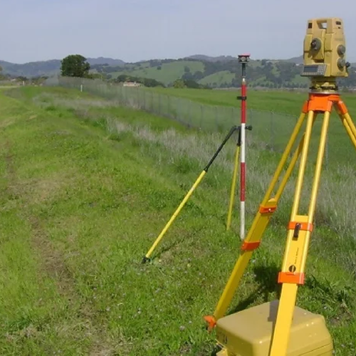
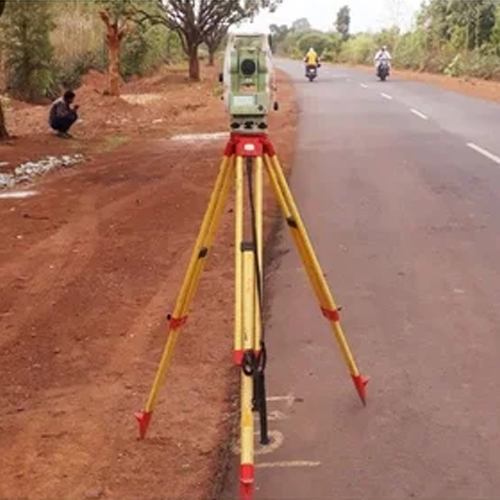
Return to shopEvery piece of land tells a story through numbers — its exact boundaries, its precise area, its coordinates on the map. Getting that story wrong, even slightly, leads to property disputes, construction errors, and legal complications that can take years to resolve. That’s why land survey, DGPS survey, and demarcation are among the most fundamental services in property ownership, construction, and infrastructure development.
We provide comprehensive land survey, DGPS survey, and demarcation services, combining traditional survey precision with modern satellite-based technology to deliver accurate, legally reliable land data—whether you’re buying property, resolving a boundary dispute, planning construction, or managing a large infrastructure project.
A land survey is the process of accurately measuring and mapping a piece of land—its boundaries, area, elevation, and physical features. It’s the single most important step before any property transaction, construction project, or land development decision.
Whether you’re an individual buying a plot, a developer planning a residential project, or a government agency managing land records, an accurate land survey protects you from:
We work with individual property owners, real estate developers, government land departments, and legal professionals, delivering land survey data that stands up to scrutiny — whether it’s used for a simple property purchase or a complex legal dispute.
Our land survey process typically includes:
This structured approach ensures that what you receive isn’t just a measurement — it’s a reliable, defensible record of your land.
DGPS (Differential Global Positioning System) survey takes standard GPS technology and dramatically improves its accuracy—from several meters of error down to centimeter-level precision. This makes DGPS surveying essential for large land parcels, remote locations, and projects where standard measurement methods fall short.
Standard GPS signals can be affected by atmospheric interference, satellite positioning errors, and signal delays—resulting in position errors of several meters. DGPS surveying corrects this by using a base station with a known, fixed position to calculate and transmit correction signals to a mobile receiver in the field. The result is dramatically more accurate positional data, even across large or difficult-to-access areas.
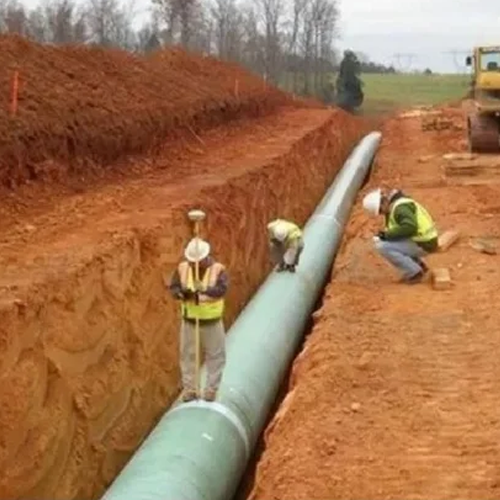
DGPS surveying is particularly valuable for government land record projects, large real estate developments, and infrastructure corridors, where covering vast areas with high positional accuracy is critical—and where traditional survey methods alone would take significantly longer.
Knowing where your property boundary lies on paper is one thing. Having it physically marked on the ground — in a way that’s legally recognized and dispute-proof — is another. This is exactly what demarcation delivers.
Demarcation Services is the process of physically marking the exact boundary points of a land parcel on the ground, based on legal land records, survey data, and revenue department documentation. It transforms abstract boundary coordinates into visible, verifiable markers — corner stones, pillars, or other physical indicators — that clearly show where one property ends and another begins.
Our demarcation process combines legal document verification with precise field survey work:
This combination of legal accuracy and field precision is what makes our demarcation services genuinely dispute-proof — not just a rough on-ground estimate, but a properly documented, legally grounded boundary determination.
These three services are often needed together, especially for:
We offer these services independently or as a combined package, depending on your project’s specific needs.
✅ Complete service range — from measurement to physical boundary marking
✅ DGPS technology for accurate, efficient large-area surveying
✅ Legally grounded demarcation — verified against official land records
✅ Experienced across residential, commercial, agricultural, and government land
✅ Survey reports formatted for legal, registration, and construction use
✅ Trusted by property owners, developers, legal professionals, and government departments
✅ Fast mobilization — team on-site within 24–48 hours
1. What is the difference between a land survey and demarcation?
A land survey measures and documents a property’s boundaries, area, and features, while demarcation physically marks those boundaries on the ground using permanent markers—making the surveyed boundaries visible and dispute-proof.
2. What is a DGPS survey and when do I need one?
A DGPS (Differential GPS) survey uses satellite-based technology with correction signals to achieve centimeter-level positional accuracy. It’s ideal for large land parcels, remote areas, agricultural land, and infrastructure projects where standard survey methods would be slower or less practical.
3. How accurate is a DGPS survey compared to a total station survey?
DGPS surveys can achieve centimeter-level accuracy, comparable to total station surveying, but cover much larger areas more quickly — making it especially valuable for large land parcels and remote locations. For very high-precision, small-area work, total station surveying combined with DGPS is often used together.
4. Is demarcation legally required before I build on my property?
While requirements vary by location and project type, demarcation is strongly recommended before construction to ensure you’re building within your actual legal boundaries — avoiding encroachment issues and future disputes with neighboring property owners.
5. Can a land survey and demarcation help resolve an existing boundary dispute?
Yes, an accurate land survey combined with proper demarcation — verified against official land records — provides legally defensible evidence that can be used to resolve boundary disputes, including in court proceedings if necessary.
6. How much do land survey, DGPS survey, and demarcation services cost?
Pricing depends on land size, terrain, survey method (total station vs. DGPS), and whether demarcation is included. Contact us for a customized quote based on your specific land and requirements.
7. How long does the entire process take — survey, DGPS mapping, and demarcation?
Timeline depends on land size and complexity. Small residential plots can often be completed within a few days, while large agricultural or infrastructure land parcels using DGPS technology may take longer depending on area coverage. We’ll provide a specific timeline once we understand your project scope.
8. Do you provide land survey and demarcation reports for legal or court use?
Yes, our reports are prepared with the documentation standards needed for legal proceedings, property registration, and government land record submissions.
Whether you’re buying a new property, resolving a boundary dispute, planning construction, or managing a large land parcel—our experienced survey team delivers the accurate, legally reliable land data you need. Contact us today for a free consultation and quote tailored to your specific land survey, DGPS survey, or demarcation requirement.