

Your cart is empty
You may check out all the available products and buy some in the shop
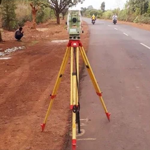
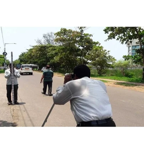
Return to shopOur L-Section and Cross-Section Survey services provide detailed ground level measurements essential for the planning, design, and construction of roads, highways, railways, canals, pipelines, and drainage projects. Using advanced surveying equipment, we deliver precise longitudinal and transverse profiles that help engineers analyze terrain conditions and create efficient project designs.
We ensure high-precision measurements, reliable data, and timely project delivery, helping engineers, contractors, and developers make informed decisions while reducing construction risks and costs.
Every road, canal, drainage channel, and pipeline project depends on one critical set of measurements: how the land rises, falls, and changes shape along the route. This is exactly what L-section (longitudinal section) and cross-section surveys capture—giving engineers the precise elevation and profile data needed to design gradients, drainage, and earthwork with confidence.
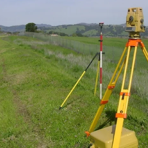
We provide specialized L-section and cross-section survey services, using total station and drone-based technology to deliver accurate profile data for road, canal, drainage, pipeline, and river engineering projects.
Our teams currently serve major districts across Madhya Pradesh, Rajasthan, Maharashtra, and Gujarat, supporting projects ranging from rural road widening to large-scale canal and irrigation infrastructure.
L-Section (Longitudinal Section) Survey captures elevation data along the centerline of a route — a road, canal, pipeline, or drainage channel — showing how the ground rises and falls along its entire length. This data is essential for gradient design, drainage planning, and earthwork calculation.
Cross-Section Survey captures elevation data perpendicular to the route at regular intervals, showing the width, depth, and side-slope profile at each point. This is critical for canal capacity design, road formation width, embankment planning, and river/drainage channel engineering.
Together, these two survey types give engineers a complete 3D picture of the project corridor — without them, design teams are working with incomplete elevation data, risking:
We work with road contractors, irrigation departments, canal and drainage authorities, pipeline EPC companies, and government infrastructure agencies across all our serviceable states.
Our team delivers precise L-section and cross-section survey services across Madhya Pradesh, supporting both road infrastructure and irrigation projects.
Districts we serve:
Bhopal, Indore, Jabalpur, Gwalior, Ujjain, Sagar, Dewas, Satna, Ratlam, Rewa, Katni, Singrauli, Chhindwara, and Vidisha.
We provide L-section survey services in Bhopal and Indore for road widening and highway projects, along with cross-section surveys for canal projects in Ujjain and Sagar, supporting the state’s irrigation infrastructure. Our team has also completed river cross-section surveys in Jabalpur and Gwalior for drainage and flood management projects.
Rajasthan’s extensive canal network and expanding road infrastructure rely on our L-section and cross-section survey expertise.
Districts we serve:
Jaipur, Jodhpur, Udaipur, Kota, Ajmer, Bikaner, Bhilwara, Alwar, Bharatpur, Sikar, Pali, Sri Ganganagar, Churu, and Jhunjhunu.
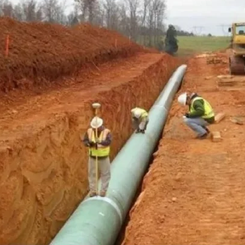
We offer L-section survey services in Jaipur and Jodhpur for road and highway gradient planning, along with cross-section surveys for canal projects in Sri Ganganagar and Bikaner — critical for the state’s irrigation canal network. Our pipeline route L-section surveys in Kota and Ajmer support water and gas pipeline infrastructure projects.
From highway projects in Mumbai and Pune to irrigation canal surveys in Nashik and Aurangabad, our team delivers accurate L-section and cross-section survey services across Maharashtra.
Districts we serve:
Mumbai, Pune, Nagpur, Nashik, Aurangabad (Chhatrapati Sambhajinagar), Thane, Solapur, Kolhapur, Amravati, Nanded, Sangli, Satara, Jalgaon, and Akola.
We provide L-section survey services in Pune and Nagpur for road and highway projects, along with cross-section surveys for canal and drainage projects in Nashik and Solapur, supporting the state’s irrigation network. Our team has also conducted river cross-section surveys in Kolhapur and Sangli for flood management planning.
Gujarat’s extensive canal irrigation network (including the Narmada canal system) and growing road infrastructure make our L-section and cross-section survey services essential across the state.
Districts we serve:
Ahmedabad, Surat, Vadodara, Rajkot, Bhavnagar, Jamnagar, Gandhinagar, Junagadh, Anand, Nadiad, Mehsana, Bharuch, Morbi, and Navsari.
We offer L-section survey services in Ahmedabad and Surat for highway and road widening projects, along with cross-section surveys for canal projects in Mehsana and Anand, supporting the state’s irrigation infrastructure. Our pipeline route surveys in Bharuch and Vadodara serve the region’s industrial pipeline network.
✅ Specialized expertise in longitudinal and cross-sectional profiling
✅ Multi-state coverage across Madhya Pradesh, Rajasthan, Maharashtra & Gujarat
✅ Total station + drone technology for accurate, fast data collection
✅ Experienced with road, canal, drainage, and pipeline projects
✅ Survey reports formatted for engineering design and approval standards
✅ Transparent, per-kilometer pricing — no hidden costs
1. What is the difference between an L-section and a cross-section survey?
An L-section (longitudinal section) survey captures elevation along the centerline of a route, while a cross-section survey captures elevation perpendicular to the route at regular intervals — together giving a complete profile of the project corridor.
2. Which locations do you provide L-section and cross-section survey services in?
We currently serve major districts across Madhya Pradesh, Rajasthan, Maharashtra, and Gujarat.
3. What types of projects need L-section and cross-section surveys?
These surveys are essential for road and highway projects, canal and irrigation systems, drainage channels, river engineering, and pipeline route planning.
4. What technology do you use for these surveys?
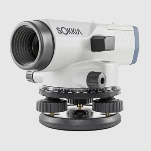
We use total station equipment for precision chainage-based profiling, combined with drone-based mapping for faster data collection on larger projects.
5. How much does an L-section and cross-section survey cost?
Pricing depends on route length, terrain, and survey interval requirements — we offer transparent per-kilometer pricing. Contact us for a customized quote.
6. How often are cross-section readings typically taken along a route?
Cross-section intervals depend on project requirements and terrain variability, typically ranging from every 20 to 100 meters — we customize this based on your project’s design needs.
Whether you’re planning a road widening project in Indore, a canal survey in Sri Ganganagar, a highway in Pune, or a pipeline route in Bharuch — our experienced survey team delivers the precise profile data your project needs. Contact us today for a free consultation and quote.
WhatsApp us
Address: 1234 Fashion Street, Suite 567,
New York, NY 10001
Email: info@fashionshop.com
You may check out all the available products and buy some in the shop
Return to shop